
LiDAR

Professional. Effective. Innovative.
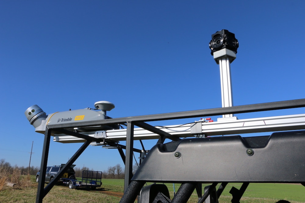
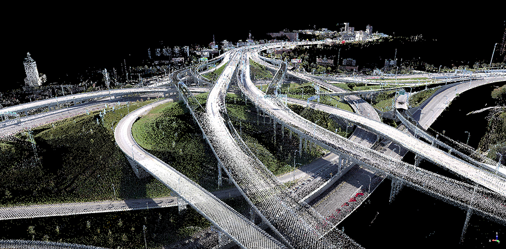
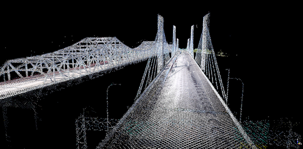
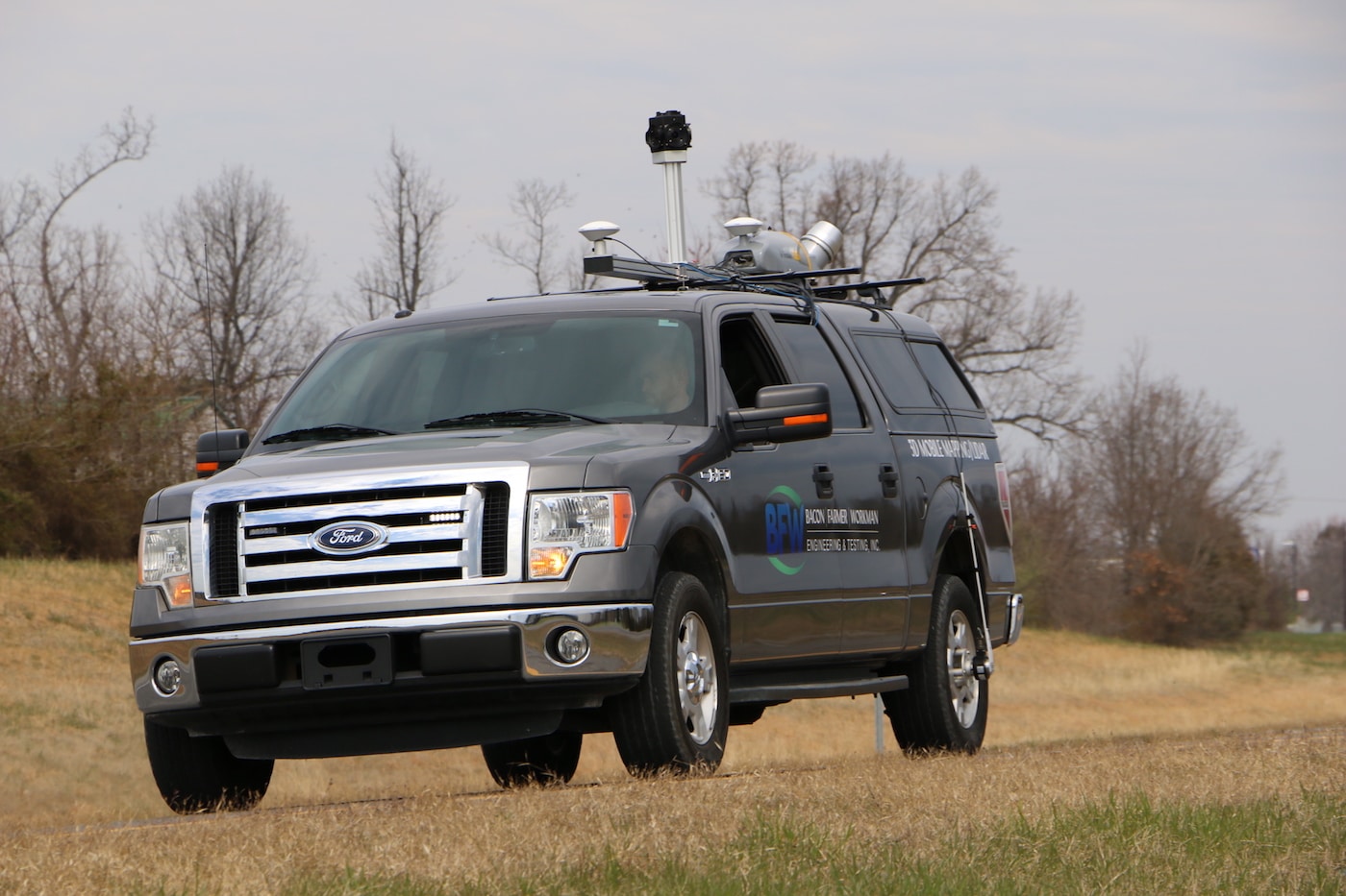
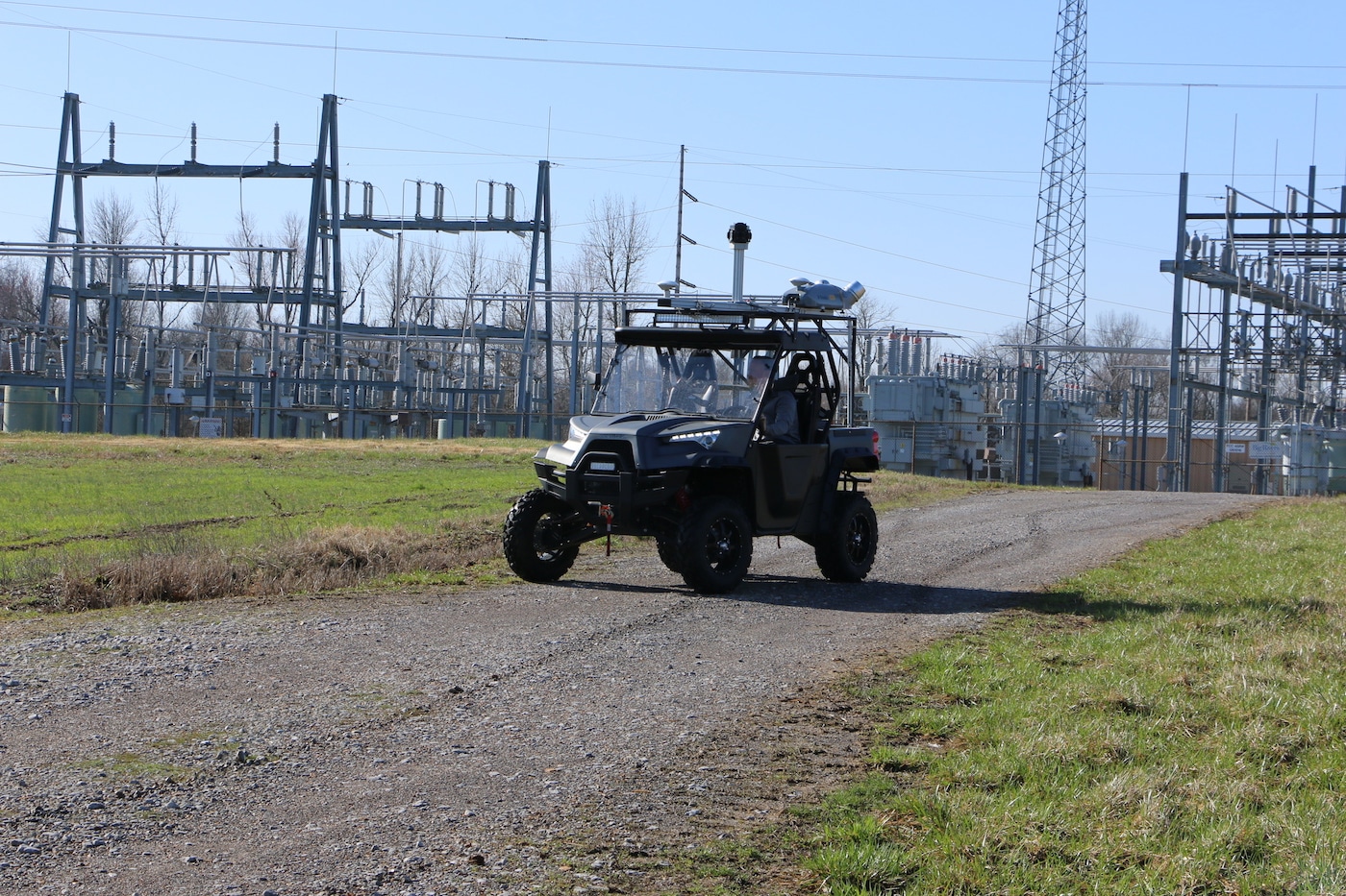
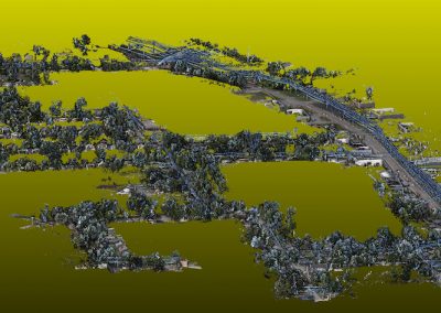
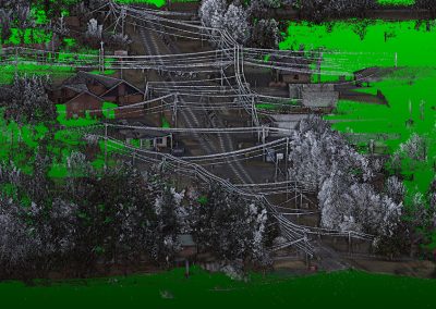
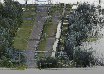
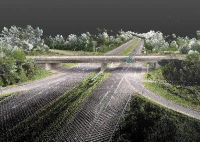
Bacon Farmer Workman Engineering & Testing, Inc. has the in-house capability of providing 3D Mobile Mapping/LIDAR using the Trimble MX2. This is a vehicle-mounted spatial imaging system which combines high-resolution laser scanning and precise positioning. The data collected offers a wide range of transportation and civil design applications.
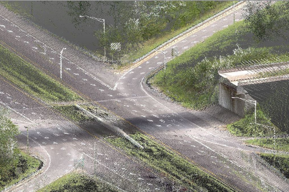
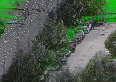
The dual head system contains a combined GNSS and inertial module for precise positioning. It can be rapidly deployed onto on-and off-road vehicles of all sizes, and significantly reduces project field time compared to traditional techniques. The LIDAR scans supplement the 3D modeling that yields more predictable designs. BFW has the necessary software to rectify and reconcile the laser point cloud information. BFW uses Trimble “RealWorks” and Trident software as a powerful visualization tool to create and manipulate the 3D scans and incorporate them into all compatible transportation/civil design platforms. Our Geospatial staff is trained to provide the necessary expertise to implement this innovative technology.
Trimble Mx2 Features:
- 360° scanning
- Flexible collection in the flow of traffic
- Sub-centimeter accuracies on hard surfaces
- DTM generation through surface modeling
- 3D infrastructure mapping
- 3D volumes
- Terrain modeling
- Bridge clearances
- Road cross sections
- GIS applications
- Utility inventory collection
- Dual head technology for more surface coverage
- Faster processing through Trimble Trident
- Dual GNSS receivers
- Pavement management
- Sign inventory
Client Benefits:
- Accuracy and Better Models
- Maximizes Point Data Coverage
- Safer Collection in High Traffic
- Applicable to Sign, Bridge & Pavement Inventories (Asset Management)

CONTACT OUR LIDAR TEAM
![]()